Guides · Marco Island, Florida
Getting to Marco Island: A Complete Guide
How to Enter Marco Island by Car
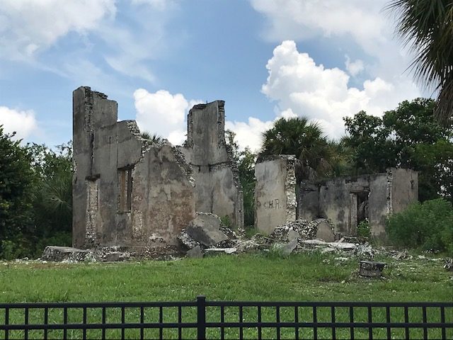
Crossing the Jolley Bridge from the mainland is the only way to arrive by car, and the transition is abrupt. South of the bridge, the Tamiami Trail runs through mangroves and sawgrass that still drain the Everglades toward the Gulf. On the island side, the road straightens into Collier Boulevard, lined with planned medians, low-rise condominiums, and the orderly geometry of a community laid out on paper. Beneath that grid, shell mounds and canal remnants mark fifteen hundred years of Calusa settlement, most of it now paved over or dredged. The bridge is the hinge. One side is the ancient water system that carried canoes between the Gulf and the Glades; the other is a landmass that did not exist in its present form until the 1960s, when the Mackle brothers of the Deltona Corporation bought the island for $7 million and engineered it into a retirement destination.
A Brief History of Marco Island's Development
For the Calusa, arrival was by water. Their domain stretched across southwest Florida from about 500 CE, and Marco Island—then a barrier island of shell ridges and mangrove estuaries—sat at the center of their territory. They built canals, some of which still carry water, and their canoe routes threaded through the backcountry that is now Everglades National Park. The island's name long predates its development; the Key Marco name attaches to the archaeological site that made it famous, excavated by Frank Hamilton Cushing in 1896. That expedition recovered wooden artifacts preserved in the muck, including the Key Marco Cat, a small carved figure now considered one of the finest pre-Columbian artworks found in North America.
The modern approach was engineered in a single decade. The Mackles dredged fill from the bay bottom to raise the island's low ground, cut canals into the interior, and sold lots to retirees and vacationers through the 1960s. The result was a planned community with a grid of waterways and streets where Calusa shell heaps once stood. Marco Island reincorporated as a city on 28 August 1997, a municipal recognition of a place that exists largely because of mid-century land development. Getting here today is not a matter of following ancient paths. It is a drive across a landscape remade to make arrival routine.
Where to Park and Start Your Visit
Two public access points give visitors a practical starting place. Tigertail Beach is one of the island's two public beach accesses with parking and amenities. Set on the Gulf side, it involves a walk across a lagoon from the parking lot to the open beach—a small reminder that the island's shoreline is still in motion. The Marco Island Historical Museum is the cultural entry point. It houses the Key Marco Cat on loan from the Smithsonian, a rare chance to see the artifact in the region where it was found. The museum also covers the Calusa occupation and the Mackle development, making it the best single stop for understanding how both histories sit under the same streets.
Seasonal vs. Year-Round Population on Marco Island
Marco Island's numbers tell a story of split identity. The census records a population of 15,998 people, with a median age of 67.7 years. Total housing units number 18,436; of those, 9,264 are held for seasonal or recreational use, and 10,003 are vacant. That means more than half the housing stock is empty for much of the year. The permanent population is relatively affluent—median household income is $104,105, and 47.9 percent of residents hold a bachelor's degree or higher—but the island's rhythm is set by the seasonal influx. Expect a fuller island from late fall through early spring, with more open restaurants and busier beaches. In summer, the island quiets, and some services scale back.
Marco Island Population and Housing Stats
| Measure | Value |
|---|---|
| Population | 15,998 |
| Median age | 67.7 years |
| Total housing units | 18,436 |
| Homes held for seasonal or recreational use | 9,264 |
| Vacant housing units | 10,003 |
| Median household income | $104,105 |
| Median home value | $866,200 |
| Median gross rent | $1,955 |
| Bachelor's degree or higher | 47.9% |
| Unemployment rate | 4.2% |
Day Trips from Marco Island
Marco Island sits at the edge of a region of small towns and festivals that run on different clocks. Everglades City, 23 miles away, holds the Everglades Seafood Festival and is the practical gateway to the Ten Thousand Islands. Arcadia, 90 miles to the north, hosts the Arcadia All-Florida Championship Rodeo. Okeechobee, 109 miles away, runs the Speckled Perch Festival and Parade. Further afield, Stuart (133 miles) has the Stuart Boat Show, Sebastian (153 miles) the Sebastian Clambake Lagoon Festival, and Dade City (170 miles) the Kumquat Festival. These are not comparisons so much as extensions. Marco is the developed edge of a landscape that still has wild, small-town pockets within a few hours' drive.
The answer to getting to Marco Island is straightforward by car: take Interstate 75 to Exit 101, then head south on Collier Boulevard across the Jolley Bridge. From Miami it is about two hours; from Naples, thirty minutes. The deeper question is what you are arriving at. The island is a place where the Calusa's fifteen-hundred-year presence and a single decade of dredge-and-fill sit side by side, separated by a bridge that makes the crossing feel like a shift in time as much as geography.
Common questions
- How did Marco Island get built up?
- The Mackle brothers of the Deltona Corporation bought the land for $7 million and developed it through the 1960s, turning a Calusa island into a retirement and tourist destination in a single decade. The island reincorporated as a city on August 28, 1997.
- What is the Key Marco Cat and where can I see it?
- The Key Marco Cat is a small carved wooden figure from Frank Hamilton Cushing's 1896 expedition, one of the finest pre-Columbian artworks found in North America. It's on loan from the Smithsonian and displayed at the Marco Island Historical Museum.
- What beaches are public on Marco Island?
- Tigertail Beach is one of the island's two public beach accesses with parking and amenities. It's a good spot to visit, though the island's development history is more about the Mackle brothers' 1960s project than natural shoreline.
- Is Marco Island mostly full-time residents or vacation homes?
- Out of 18,436 total housing units, 9,264 are held for seasonal or recreational use, and 10,003 are vacant. The median age is 67.7 years, and the population is 15,998, so it's heavily skewed toward part-time and older residents.
- What's the history before the Mackle brothers?
- The Calusa lived here from about 500 CE, and the Key Marco name attaches to the archaeological site that made it famous. The island's name long predates its development, but the modern island was made by dredge and fill in the 1960s.
- How far is Everglades City from Marco Island?
- Everglades City is 23 miles away, and it hosts the Everglades Seafood Festival. It's a reasonable day trip if you want to see a different side of Collier County, though Marco Island itself has its own historical museum.
Every business named above is one we hold a listing for, and every date traces to a source on our sources page. We do not describe menus, interiors or service we have not verified. Details change — confirm before you travel.